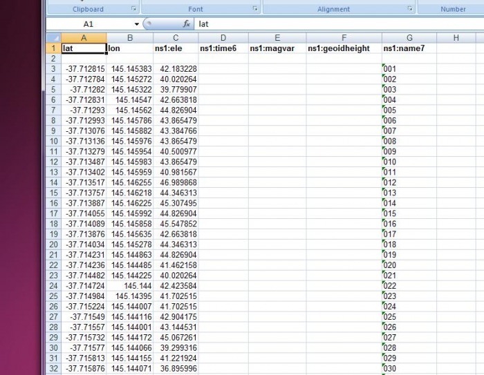
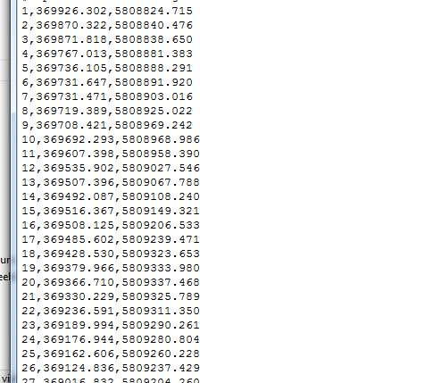
Data sets in different coordinate systems can be translated to a common coordinate system, allowing combination of different data sets to be accurately displayed within a single drawing, or to be superimposed over an aerial photo. Data that may have been collected and expressed (for example) in the older AMG coordinate system can be converted to the current MGA format. Alternatively, data can be simply queried into a drawing with a different coordinate system and still display correctly.